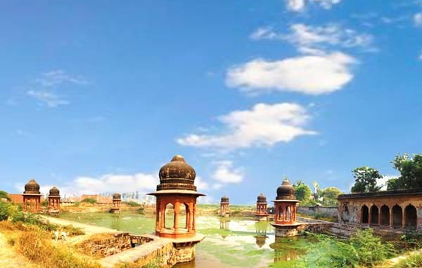
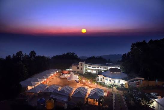
Arwal is a small district in Bihar’s Magadh Division, with Arwal town serving as its administrative headquarters. The district was created in August 2001 after being separated from Jehanabad district. Arwal lies on the right bank of the Son River and has a predominantly agricultural economy, with paddy, wheat and maize among its major crops. Its location between Patna, Jehanabad, Aurangabad and Bhojpur gives it useful road connectivity despite the absence of a railway line within the district. The current district administration records an area of 634.23 sq. km and a Census 2011 population of 7,00,843.
Quick Overview of Arwal District
| Particular | Details |
| State | Bihar |
| Administrative Division | Magadh Division |
| District Headquarters | Arwal |
| District Formation | August 2001 |
| Area | 634.23 sq. km |
| Population | 7,00,843 |
| Literacy Rate | 67.43% |
| Sub-Divisions | 1 |
| Blocks | 5 |
| Anchals | 5 |
| Gram Panchayats | 65 |
| Revenue Villages | 315 |
| Main Urban Body | Arwal Nagar Parishad |
| Main Court | Arwal Sub-Divisional Civil Court |
| Judicial Judgeship | Jehanabad |
| Railway Station in District | None |
| Nearest Railway Station | Jehanabad |
| Railway Station Code | JHD |
| Railway Zone | East Central Railway |
| Railway Division | Danapur Division |
| Main Arwal PIN Code | 804401 |
| Nearest Airport | Jay Prakash Narayan Airport, Patna |
| Official District Website | arwal.nic.in |
The official demography table records one subdivision, five blocks, 65 Gram Panchayats and 315 revenue villages. Census 2011 records the district literacy rate at 67.43%.
Location of Arwal District
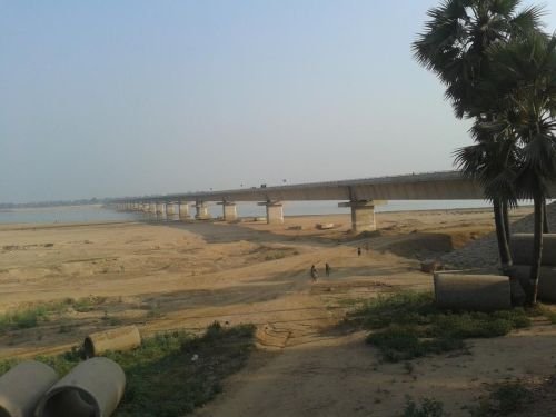
Arwal lies in the south-central part of Bihar. Arwal town is situated on the right bank of the Son River, an important tributary of the Ganga.
The district shares boundaries with:
- Patna
- Jehanabad
- Aurangabad
- Bhojpur
Arwal headquarters is approximately 65 km from Patna. Road connections with Patna, Jehanabad, Aurangabad and Bhojpur make the town accessible from several directions. The Arwal–Sahar bridge also provides connectivity towards Bhojpur.
Agriculture dominates the local economy. Paddy, wheat and maize are important crops, while a substantial part of the district’s land is used for cultivation.
Administration of Arwal District
Arwal town is the district administrative headquarters and the district falls under Magadh Division.
Arwal has only one subdivision, also named Arwal.
The five development blocks are:
- Arwal
- Kaler
- Karpi
- Kurtha
- Sonbhadra Banshi Suryapur
The same five areas also function as anchals for revenue administration.
Block and Anchal offices handle rural-development schemes, land records, revenue matters, certificates and other local government services.
Arwal Nagar Parishad
Arwal is the district’s principal urban centre and is governed by Arwal Nagar Parishad.
Census records identify Arwal as the district’s statutory urban centre. The Nagar Parishad is responsible for services such as:
- Sanitation
- Drainage
- Local roads
- Street lighting
- Waste management
- Other municipal functions
Arwal town also contains the Collectorate, Civil Court and other important district offices.
Arwal District Court
Arwal has a functioning Civil Court complex, but its judicial arrangement is slightly different from many other Bihar districts.
The district administration calls the establishment the District Civil Court. However, Government of India judicial data for March 2026 states that Arwal functions as a Sub-Divisional Court under the Jehanabad Judgeship, and its case data is included with Jehanabad in the National Judicial Data Grid.
The Arwal court establishment includes district/additional sessions-level judicial officers along with civil and magistrate courts. Citizens can use eCourts services for case status, hearing dates, orders and cause lists.
Court Location
The court is located at:
Arwal Sub-Court, Arwal S.O., Arwal, Bihar – 804401
A Bihar government court-connectivity document officially identifies this address and classifies Arwal as a Sub-Divisional Court.
The court is within Arwal town and is convenient to the Sub-Divisional Office, Collectorate and main road network.
Railway Station in Arwal District
Arwal district does not currently have a railway line or railway station. The district administration clearly confirms that rail connectivity is absent.
For practical rail access, the district history page identifies Jehanabad Railway Station as the nearest railway station. Some other district tourism pages mention Patna as a major railhead, so travellers coming from distant cities may compare both options.
Jehanabad Railway Station
Station Code: JHD
Jehanabad Railway Station belongs to East Central Railway’s Danapur Division. It lies on the Patna–Gaya railway corridor.
Passengers arriving at Jehanabad must continue to Arwal by road using a bus, taxi or shared vehicle.
Road Connectivity
Road transport is the main mode of travel in Arwal district.
Important road connections lead towards:
- Patna
- Jehanabad
- Aurangabad
- Bhojpur
- Daudnagar-side areas
The district’s official travel information confirms good road connectivity with all four neighbouring districts.
Because there is no rail line, buses, shared vehicles and private taxis play an especially important role in local and inter-district travel.
Nearest Airport to Arwal
The nearest airport is Jay Prakash Narayan Airport, Patna.
The district administration places Patna Airport approximately 65 km from Arwal.
Travellers arriving by air can continue to Arwal directly by taxi or use bus connections from Patna.
Arwal Pin Code
The main PIN code of Arwal town is 804401.
India Post officially lists:
Arwal – 804401.
Other important postal codes include:
- Baiderabad – 804402
- Karpi – 804419
- Kaler – 824127
Different villages and localities use separate PIN codes, so 804401 should not automatically be used for every address in Arwal district.
Major Tourist Places in Arwal District
Makhdum Shah Ka Mazaar
Makhdum Shah Ka Mazaar is one of the religious sites officially promoted by the Arwal district tourism department. It is accessible by road from the Patna side.
Madhusrava Ashram
Madhusrava Ashram is another recognised religious and cultural attraction in the district and can be reached through the main road network.
Fakharpur Mandir
Fakharpur Mandir is situated in Fakharpur Panchayat and is listed among Arwal’s principal tourist and religious places.
Aganur Jal Vidyut Pariyojna
The Aganur Jal Vidyut project is located in Kaler block and is also included by the district administration among Arwal’s places of interest.
FAQs About Arwal District
Q. Should I book a train to Jehanabad or Patna for visiting Arwal?
Jehanabad is the nearer practical railhead identified on the district history page, while Patna is a much larger station with considerably more long-distance trains. Choose Jehanabad when your train stops there conveniently; otherwise Patna may provide better train options.
Q. Is Arwal practical for a day trip from Patna?
Yes. Arwal is approximately 65 km from Patna, so a same-day road trip is possible. Travel is entirely by road, so starting early is preferable if more than one place is being visited.
Q. Why does Arwal not appear as a separate judgeship on some eCourts lists?
Although Arwal is a separate civil district, Government of India judicial data states that its courts currently form a sub-divisional court under Jehanabad Judgeship. This is why some judiciary databases group Arwal case statistics with Jehanabad.
Q. Is road travel the only direct way to reach Arwal?
Yes. There is currently no railway line in Arwal district, and the nearest airport is in Patna. Therefore, the final part of a journey to Arwal must be completed by road, whether the traveller arrives initially by train or air.