Kupwara is the northern frontier district of the Kashmir Valley in the Union Territory of Jammu and Kashmir, with Kupwara town as its administrative headquarters. It was carved out of the former Baramulla district in 1979 and lies between the Pir Panjal and Shams Bari mountain systems. Much of the district is mountainous and forested, with high passes opening towards remote border valleys such as Karnah, Keran and Machil.
Kupwara is best known for the Lolab and Bangus valleys, Seemab Valley, Sadhna Pass and the scenic Kishanganga-side settlements of Keran. The district administration records a geographical area of 2,379 sq. km. Final Census 2011 records give a population of 8,70,354 and literacy rate of 64.51%.
Quick Overview of Kupwara District
| Particular | Details |
| Union Territory | Jammu and Kashmir |
| Division | Kashmir Division |
| District Headquarters | Kupwara |
| District Formation | 1979 |
| Area | 2,379 sq. km |
| Population | 8,70,354 – final Census 2011 |
| Literacy Rate | 64.51% – final Census 2011 |
| Subdivisions | 2 |
| Tehsils | 16 |
| Development Blocks | 24 in current administrative summary |
| Gram Panchayats | 356 |
| Villages | 367 on Demography page; homepage shows 363 |
| Urban Local Bodies | Kupwara, Handwara and Langate |
| Main Court | Principal District & Sessions Court, Kupwara |
| Main Kupwara PIN Code | 193222 |
| Railway Station in District | None |
| Nearest Railheads | Sopore and Baramulla |
| Sopore Station Code | SXZM |
| Baramulla Station Code | BRML |
| Nearest Airport | Sheikh-ul-Alam International Airport, Srinagar |
| Main Highway | NH-701 |
| Official District Website | kupwara.nic.in |
Official data needs careful reading. The district’s administrative summary lists 2 subdivisions, 16 tehsils, 24 development blocks and 356 Gram Panchayats. However, its separate Subdivision & Blocks page currently displays only 21 block names. Similarly, the Demography page shows 367 villages while the homepage shows 363. The discrepancies appear to come from pages maintained on different schedules.
Location of Kupwara District
Kupwara lies in the extreme north-west of the Kashmir Valley. Baramulla and Bandipora districts lie towards the south and south-east, while a long stretch of the district meets the Line of Control in the north and west.
Kupwara town is roughly 90 to 110 km from Srinagar, depending on the route and reference point. The district administration places the district headquarters at an average altitude of around 5,300 feet.
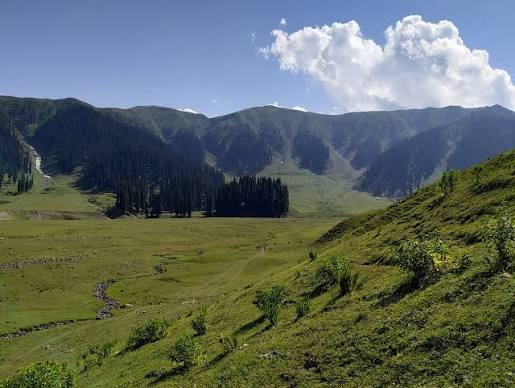
The district is highly mountainous. Dense deodar, pine and fir forests cover large parts of the Shams Bari range, while fertile valleys support agriculture, orchards and livestock.
High passes including Sadhna Pass and Farkiyan Gali provide access to remote areas. Heavy snowfall can temporarily cut off Karnah, Keran and Machil from the main Kashmir Valley during winter.
Administration of Kupwara District
Kupwara town is the district headquarters. The current administrative setup records 2 subdivisions, 16 tehsils, 24 development blocks and 356 Gram Panchayats.
Subdivisions
- Karnah Subdivision
- Lolab Subdivision
Tehsils
- Kupwara
- Handwara
- Karnah
- Keran
- Kralpora
- Trehgam
- Machil
- Drugmulla
- Ramhal
- Qaziabad / Kralgund
- Langate
- Zachaldara
- Lolab / Sogam
- Lalpora
- Villgam
- Kalamabad
The current dedicated Tehsils page confirms all 16 tehsils.
The separate block-list page currently names only 21 blocks even though the main administrative summary gives a district total of 24. Because the two official pages do not fully reconcile, 24 is the better official total, but the shorter block list should not be presented as exhaustive.
Urban Local Bodies
Current district urban-department and delimitation records identify three principal urban bodies:
- Municipal Council Kupwara
- Municipal Committee Handwara
- Municipal Committee Langate
Kupwara District Court
Kupwara became a separate district in 1979. The Court of the Principal District and Sessions Judge began functioning on 1 March 1980.
The current High Court of Jammu & Kashmir and Ladakh listing confirms the Principal District & Sessions Judge at Kupwara along with subordinate judicial establishments.
District Court Location
District Court Complex, Kupwara, Jammu and Kashmir – 193222
The wider Kupwara judiciary currently includes courts at:
- Kupwara
- Handwara
- Sogam
- Tangdhar/Karnah
- Kralpora
- Trehgam
The High Court’s organisational material confirms the District Court Complex at Kupwara and the Additional District & Sessions Court complex at Handwara.
Litigants should verify the exact court and cause list through eCourts before travelling.
Railway Connectivity in Kupwara District
Kupwara district does not currently have its own railway station. The district administration identifies Sopore and Baramulla as the nearest railheads.
Sopore Railway Station
Station Code: SXZM
Indian Railways lists Sopore as an NSG-6 Northern Railway station under Firozpur Division. It is one of the practical railheads for passengers continuing by road towards Handwara and Kupwara.
Baramulla Railway Station
Station Code: BRML
Indian Railways also lists Baramulla as an NSG-6 Northern Railway station under Firozpur Division.
Kupwara’s tourism pages commonly quote Baramulla at about 64 km from Kupwara. Travellers should compare Sopore and Baramulla according to the particular train and onward road connection.
Road Connectivity
Road is the main form of access to Kupwara.
National Highway 701 runs from Baramulla through Rafiabad and Kupwara towards Tangdhar. Government highway records describe the route as Baramulla–Rafiabad–Kupwara–Tangdhar.
The district administration has also published land-acquisition records for improvement of the NH-701 Rafiabad–Kupwara–Chowkibal–Tangdhar–Chamkote road.
Regular buses, shared taxis and cabs operate from Srinagar and other parts of the Kashmir Valley.
Roads towards Sadhna Pass, Karnah, Keran and Machil are mountain routes and can be affected by snowfall, landslides, weather-related closures and access restrictions. Travellers should check conditions before starting for remote areas.
Nearest Airport to Kupwara
Kupwara has no commercial airport.
The nearest airport is Sheikh-ul-Alam International Airport at Srinagar. The current district How to Reach page gives a distance of approximately 93 km from Kupwara.
Individual tourism pages quote around 90–95 km depending on the destination and route. From the airport, the remaining journey is by road through Srinagar and north Kashmir.
Kupwara Pin Code
The main PIN code of Kupwara town and the Deputy Commissioner Office area is 193222. The current district Revenue Department page confirms the DC Office Complex at Kupwara under PIN 193222.
Important postal codes include:
- Kupwara – 193222
- Handwara – 193221
- Sogam – 193223
- Trehgam – 193224
- Tangdhar – 193225
- Langate – 193302
India Post confirms these post offices and PIN codes in its current postal directory.
Therefore, 193222 should not be treated as the PIN code for the entire district.
Major Tourist Places in Kupwara District
Lolab Valley
Lolab is one of Kupwara’s best-known scenic areas. The current district tourism page describes a valley extending for roughly 25 km, crossed by the Lalkul or Lahwal stream and surrounded by dense forests, orchards, villages and pastures.
Sogam, Chandigam, Diver, Anderbug, Lalpore and Kalaroos are among the better-known places within the valley.
Bangus Valley
Bangus lies on the Handwara side of the district at around 10,000 feet above sea level.
The main Bodh Bangus valley and the smaller Lokut Bangus valley contain broad green meadows, streams and surrounding coniferous forests. The district tourism page gives the principal valley an estimated area of roughly 300 sq. km.
Seemab Valley
Seemab Valley lies only about 4 km from the Tourist Reception Centre at Kupwara, near the entrance to Lolab Valley.
The perennial Daal Kul stream, forests and easy road access make it suitable for picnics, short nature trips, trekking and limited adventure activities.
Sadhna Pass
Sadhna Pass, previously known as Nastachun Pass, crosses the Shams Bari range and connects Karnah with the rest of the Kashmir Valley.
The district tourism page places it at roughly 3,130 metres above sea level. The pass offers dramatic mountain scenery, but weather conditions can change quickly.
Keran Valley
Keran is a scenic border valley on the Kishanganga River. The district tourism page highlights its mountain setting and suggests May to August as a particularly suitable visiting period.
Because Keran is a sensitive border area, tourists should check current entry and identity-document requirements before travelling.
Machil and Border-Area Travel
Machil is another remote mountain valley of Kupwara. Its access route crosses high terrain and can become difficult or inaccessible during winter.
Importantly, the current Kupwara district homepage provides an online ePermission facility for visits to the border areas of Machil, Karnah and Keran. Visitors should obtain any permission currently required and check road and security advisories before departure.
FAQs About Kupwara District
Q. Does Kupwara district have a railway station?
No. The district administration identifies Sopore and Baramulla as the nearest railheads. Sopore has station code SXZM and Baramulla has code BRML.
Q. Which airport is nearest to Kupwara?
Sheikh-ul-Alam International Airport at Srinagar is the nearest airport. The current district travel page gives a distance of about 93 km.
Q. How many tehsils are there in Kupwara district?
The current district administration lists 16 tehsils.
Q. Why do Kupwara population figures differ on government pages?
The district Demography page currently displays 8,75,564, but the final Census 2011 District Census Handbook records 8,70,354 people and literacy of 64.51%. The final Census record is the more authoritative historical census figure.
Q. Do tourists need permission for Keran, Machil or Karnah?
The district homepage currently provides an ePermission facility for border-area visits to Machil, Karnah and Keran. Visitors should check the latest permission and travel-advisory requirements before travelling.
Q. Which places are easiest to visit from Kupwara town?
Seemab Valley and Lolab are among the easiest scenic excursions. Bangus requires a longer road journey, while Keran, Karnah and Machil involve more remote mountain and border routes.