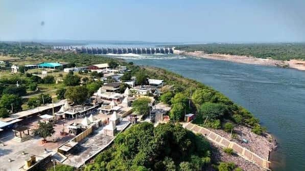
Latehar is a forest-rich district in north-western Jharkhand and forms part of the Palamu Division, with Latehar town as its administrative headquarters. The district was created on 4 April 2001 after the former Latehar subdivision was separated from Palamu district.
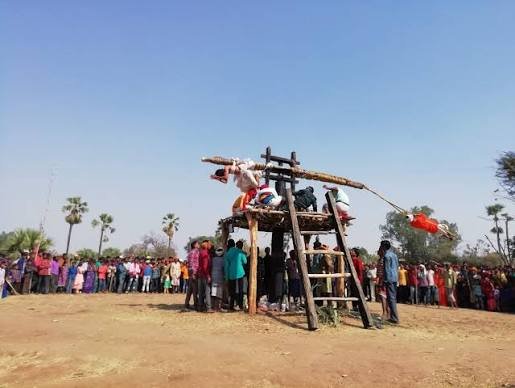
It is known for its large tribal population, sal forests, coal and other mineral resources, wildlife landscapes and some of Jharkhand’s best-known nature destinations. Netarhat, Betla National Park, Lodh Waterfall, Magnolia Sunset Point, Koel View Point and Maa Ugratara Temple are among the major attractions.
The current district homepage records an area of about 3,622 sq. km and a Census 2011 population of 7,26,978. The district Demography page gives an overall literacy rate of 59.51 percent.
Quick Overview of Latehar District
| Particular | Details |
| State | Jharkhand |
| Division | Palamu Division |
| District Headquarters | Latehar |
| District Formation | 4 April 2001 |
| Area | About 3,622 sq. km; detailed profile gives 3,622.50 sq. km |
| Population | 7,26,978 |
| Literacy Rate | 59.51% |
| Scheduled Tribe Population | 3,31,096 |
| Subdivisions | 2 |
| Blocks | 10 |
| Circles | 10 |
| Gram Panchayats | 115 |
| Villages | 773 on current homepage; other pages show 772 or 774 |
| Urban Local Body | Latehar Nagar Panchayat |
| Main Court | District & Sessions Court, Latehar |
| Court / Town PIN | 829206 |
| Main Railway Station | Latehar Railway Station |
| Railway Station Code | LTHR |
| Railway Zone | East Central Railway |
| Railway Division | Dhanbad Division |
| Station Category | NSG-5 |
| Main Highway | NH-39 |
| Nearest Airport | Birsa Munda Airport, Ranchi |
| Official District Website | latehar.nic.in |
The Latehar portal currently contains a few conflicting administrative counters. The live homepage and dedicated Block page show 10 blocks, including Saryu, while an older Subdivision page still describes the district as having nine.
Village totals also vary: the homepage shows 773, the Village & Panchayats introduction says 774 and the same page’s administrative table says 772. For current use, this guide follows the newer 10-block setup and the homepage’s 773-village counter while noting the discrepancy.
Location of Latehar District
Latehar lies in north-western Jharkhand in the Palamu region. It shares boundaries with Palamu, Chatra, Ranchi, Lohardaga and Gumla districts and also approaches the Chhattisgarh side through its forested western and southern belt.
Latehar town stands on the Ranchi-Medininagar road corridor and is around 108 km from Ranchi by road according to the district administration.
The district has an undulating plateau landscape with extensive forests, hills, river valleys and mineral-bearing areas. A large part of the population lives in rural and tribal communities.
Scheduled Tribes account for 3,31,096 people, or about 45.5 percent of the Census 2011 population, making tribal culture and forest-based livelihoods important parts of Latehar’s identity.
Administration of Latehar District
Latehar town is the district headquarters. The district currently has 2 subdivisions, 10 blocks, 10 circles, 115 Gram Panchayats and one Nagar Panchayat.
Subdivisions
- Latehar Sadar Subdivision
- Mahuadanr Subdivision
Current Blocks
- Latehar
- Chandwa
- Balumath
- Manika
- Barwadih
- Garu
- Mahuadanr
- Bariyatu
- Herhanj
- Saryu
Saryu is the important addition that explains why the current Block page shows 10 blocks while older administrative descriptions show nine.
The detailed Village & Panchayats page records 115 Gram Panchayats across the district.
Urban Local Body
Latehar Nagar Panchayat is the district’s principal urban local body. The current district directory continues to list a separate Executive Officer for the Nagar Panchayat.
The remainder of Latehar is predominantly rural and is administered through the block, circle and Gram Panchayat structure.
Latehar District Court
The principal judicial establishment is the District & Sessions Court at Latehar.
The current district Courts page identifies the District Sessions Court as the district-level court, while the Jharkhand State Legal Services Authority lists the District Legal Services Authority at Latehar Civil Court.
District Court Location
Latehar District Court / Civil Court, Bariatukhalsa, Latehar, Jharkhand – 829206
The court complex serves district-level civil and criminal matters. Citizens can check case status, hearing dates, cause lists, orders and CNR details through the eCourts system.
The PIN 829206 is also used for Latehar town and major district administrative offices.
Latehar Railway Station
Unlike several forest districts, Latehar has its own railway station and direct train connectivity with Ranchi and the wider east-central railway network.
Railway Station Code: LTHR
East Central Railway lists Latehar as an NSG-5 station under the Dhanbad Division.
The district How to Reach page lists direct train services between Ranchi and Latehar, including long-distance trains using the Barkakana-Daltonganj route.
Latehar Railway Station itself uses PIN 829207, while central Latehar town uses 829206.
Barwadih Junction is another important station for visitors heading towards Betla National Park, Palamu Fort and the western forest belt.
Road Connectivity
Latehar is well connected by road with Ranchi and Medininagar.
NH-39, the renumbered form of the old NH-75, runs through the Ranchi-Latehar-Medininagar corridor and is the district’s principal long-distance road.
The district administration places the Ranchi-Latehar road distance at about 108 km.
Roads from Latehar and Chandwa lead towards Netarhat, Mahuadanr, Barwadih and other forest areas. Jharkhand Forest Department material also identifies State Highway 09 as an important connection towards Netarhat and Lodh Falls.
During the monsoon, travellers should allow additional time on hilly and forest roads.
Nearest Airport to Latehar
Latehar does not have a commercial airport.
The current district How to Reach page identifies Ranchi Airport as the nearest airport. Birsa Munda Airport at Ranchi is therefore the main air gateway for Latehar town, Chandwa and most eastern parts of the district.
After landing at Ranchi, the onward trip is by road or rail. For remote destinations such as Netarhat, Mahuadanr, Lodh Falls and Betla, road travel remains necessary for the final part of the journey.
Latehar Pin Code
The main PIN code of Latehar town is 829206. India Post lists Latehar as an important district-headquarters post office under this PIN, while Latehar Railway Station uses 829207.
- Latehar – 829206
- Latehar Railway Station – 829207
- Chandwa – 829203
- Balumath – 829202
- Barwadih – 822111
- Mahuadanr area – 822119
The district covers a large rural and forested area, so additional PIN codes are used for many villages. The exact post office should be checked before using a postal code for an official address.
Major Tourist Places in Latehar District
Netarhat
Netarhat is the district’s best-known hill destination and lies in Mahuadanr Block. The current tourism portal places the main Netarhat attractions about 82 to 91 km from Latehar headquarters.
The plateau is known for cool weather, forests, sunrise and sunset viewpoints, Netarhat Residential School, Pine Forest, Pear Orchard and old colonial-era buildings.
Magnolia Sunset Point and Koel View Point
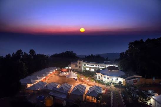
Magnolia Sunset Point is about 91 km from Latehar headquarters and is one of Netarhat’s most popular evening viewpoints.
Koel View Point is about 85 km from Latehar and roughly 3 km from Netarhat bus station, offering broad views towards the Koel River and surrounding plateau landscape.
Betla National Park
Betla National Park lies in Barwadih Block within the Palamu Tiger Reserve landscape.
The current district tourism page places it about 65 km from Latehar headquarters and describes a 226-sq-km park with sal and bamboo forests, watchtowers and guided safari opportunities.
Barwadih Junction is the nearest important railway station for this side of the district.
Lodh Waterfall / Budha Ghagh
Lodh Waterfall in Mahuadanr Block is one of Jharkhand’s highest waterfalls, with the district tourism page giving a height of approximately 468 feet.
It lies roughly 142 km from Latehar headquarters and around 61 km from Netarhat.
The administration specifically advises visitors not to swim near the base and to avoid the slippery rocks during heavy rain.
Maa Ugratara Temple, Chandwa
Maa Nagar Bhagwati Ugratara Temple is a major religious destination in Chandwa Block.
The district tourism page places it about 37 km from Latehar headquarters and around 10 km from Chandwa town, along the Chandwa-Balumath road corridor.
Navratri is an especially important period for the shrine.
Palamu Fort and Waterfall Circuit
The Latehar tourism list also includes Palamu Fort in Barwadih Block, Kanti Waterfall near Chandwa, Upper Ghaghri Waterfall near Netarhat, Datam Patam Waterfall in Herhanj and Indra Dawan Waterfall close to Latehar.
These sites make Latehar suitable for a multi-day nature, heritage and wildlife circuit rather than only a single-stop visit.
FAQs About Latehar District
Q. How many blocks does Latehar district currently have?
The current homepage and dedicated Block page show 10 blocks, including Saryu. An older Subdivision page still says nine, which is why conflicting totals appear online.
Q. Does Latehar have its own railway station?
Yes. Latehar Railway Station, code LTHR, is an NSG-5 East Central Railway station under Dhanbad Division. The district administration lists direct train connectivity with Ranchi.
Q. Which station is best for Betla National Park?
Barwadih Junction is the nearest practical railhead for Betla. The district tourism page places Betla about 15 km from Barwadih.
Q. Which airport is nearest to Latehar?
Birsa Munda Airport at Ranchi is the nearest major airport. Latehar itself does not have a commercial airport.
Q. Is Netarhat in Latehar district?
Yes. Netarhat and its main viewpoints, forests and educational heritage sites are in Mahuadanr Block of Latehar district.
Q. Why do official pages show different village counts?
The current Latehar portal is internally inconsistent: the homepage shows 773 villages, the Village & Panchayats introduction says 774 and its administrative table says 772. The difference appears to reflect pages maintained on different schedules.