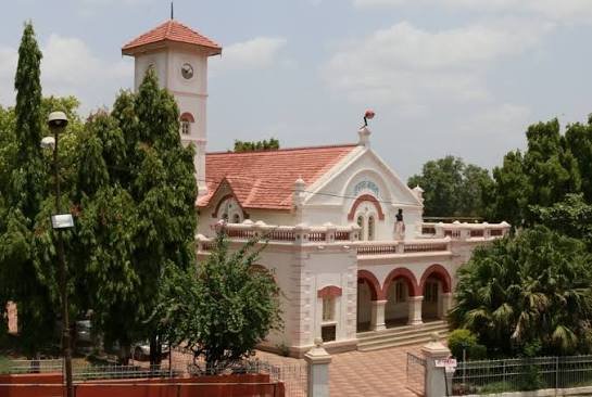
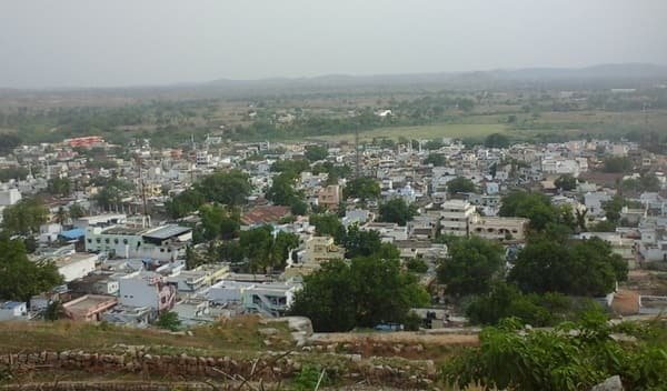
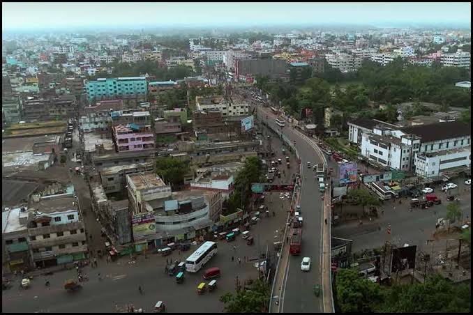
Chittoor is a major border district in southern Andhra Pradesh and one of the historic districts of the Rayalaseema region, with Chittoor city as its administrative headquarters. The district was constituted on 1 April 1911 and has repeatedly changed shape through state reorganisation and later district reforms. A major reorganisation on 4 April 2022 reduced the old district, and another boundary adjustment at the end of 2025 transferred Punganur, Chowdepalle, Sodam and Somala mandals to Annamayya district.
The current Chittoor district therefore extends from the Chittoor-Nagari belt in the east to Palamaner and Kuppam near Karnataka in the west and south-west. It is known for mango and tomato production, cross-border trade, forested hill tracts, important temples and strong road and railway links with Chennai and Bengaluru. Kanipakam, Kaigal Waterfalls, Ardhagiri, Mogili, Vepenjeri and the Kangundi heritage area are among its notable visitor destinations.

Quick Overview of Chittoor District
| Particular | Details |
| State | Andhra Pradesh |
| Region | Rayalaseema |
| District Headquarters | Chittoor |
| District Formation | 1 April 1911 |
| Major Reorganisation | 4 April 2022 |
| Latest Boundary Adjustment | Effective 31 December 2025 |
| Current Revenue Divisions | 4 |
| Current Revenue Mandals | 28 |
| Area | 6,860 sq. km on current portal; appears based on pre-Dec-2025 boundary |
| Population | 18.73 lakh on current portal; revised post-Dec-2025 total not yet published |
| Gram Panchayats | Portal still shows 697 from older 31-mandal dataset |
| Villages | Portal still shows 822 from older 31-mandal dataset |
| Urban Local Bodies | 1 Municipal Corporation + 3 current municipalities |
| Main Court | District & Sessions Court, Chittoor |
| Main Railway Station | Chittoor Railway Station |
| Railway Station Code | CTO |
| Railway Zone | South Central Railway |
| Railway Division | Guntakal Division |
| Station Category | NSG-4 |
| Main Chittoor PIN Code | 517001 |
| Nearest Operational Airport | Tirupati Airport, Renigunta |
| Official District Website | chittoor.ap.gov.in |
The district portal is currently in transition after the late-2025 boundary change. Its live Mandal page now lists 28 mandals, and current Annamayya district records separately list Punganur, Chowdepalle, Sodam and Somala there. However, Chittoor’s homepage and Demography page still display the older 2022 figures of 31 mandals, 697 Gram Panchayats, 822 villages, 6,860 sq. km and 18.73 lakh population.
Until a revised official statistical abstract is published, those population, area, Panchayat and village totals should therefore be treated as legacy figures rather than exact post-2025 totals.
Location of Chittoor District
Chittoor lies at the southern edge of Andhra Pradesh and shares long interstate boundaries with Tamil Nadu and Karnataka. Tirupati district lies to the east and north-east, while Annamayya district lies to the north and north-west. This three-state location has made Chittoor an important transport, trading and agricultural district.
The landscape changes from the plains around Chittoor and Nagari to wooded hills and higher terrain around Palamaner, Baireddipalle, Venkatagirikota and Kuppam. Mango, tomato and other horticultural produce are important to the local economy. The district is also known for dairy, food processing, granite and mineral activity, education and cross-border commerce.
Administration of Chittoor District
Chittoor city is the district headquarters. The current administration has four revenue divisions:
- Chittoor
- Palamaner
- Kuppam
- Nagari
The live 2026 Mandal page lists 28 revenue mandals.
Nagari Revenue Division
- Palasamudram
- Karvetinagar
- Nagari
- Nindra
- Vijayapuram
Chittoor Revenue Division
- Chittoor Urban
- Chittoor Rural
- Gudipala
- Yadamari
- Gangadhara Nellore
- Puthalapattu
- Penumuru
- Thavanampalle
- Irala
- Pulicherla
- Rompicherla
- Srirangarajapuram
- Vedurukuppam
- Bangarupalem
Palamaner Revenue Division
- Palamaner
- Gangavaram
- Peddapanjani
- Baireddipalle
- Venkatagirikota
Kuppam Revenue Division
- Kuppam
- Santhipuram
- Gudupalle
- Ramakuppam
The updated list is important because older Chittoor pages still contain Punganur-side statistics. Under the late-2025 reorganisation, Punganur and Chowdepalle moved to the Madanapalle Revenue Division of Annamayya district, while Sodam and Somala moved to Annamayya’s Pileru Revenue Division. Bangarupalem is now shown under Chittoor Revenue Division.
Urban Local Bodies
The current urban structure consists of:
- Chittoor Municipal Corporation
- Palamaner Municipality
- Nagari Municipality
- Kuppam Municipality
Punganur Municipality should no longer be counted under Chittoor after the boundary transfer.
Chittoor District Court
The principal judicial establishment is the District and Sessions Court at Chittoor. The District Court Buildings complex also accommodates the District Legal Services Authority and other civil and criminal judicial establishments.
Separate court premises operate at Kuppam, Nagari and Palamaner, among other locations connected with the Chittoor judgeship.
District Court Location
District Court Buildings, Chittoor, Andhra Pradesh – 517001
The Andhra Pradesh State Legal Services Authority lists the Chittoor District Legal Services Authority at Nyaya Seva Sadan, District Court Buildings, Chittoor.
Litigants should check the exact court and hearing location before travelling because subordinate matters may be listed at a local court complex. Case status, orders, hearing dates and CNR details are available through eCourts.
Chittoor Railway Station
Chittoor Railway Station is the main railway station for the district headquarters.
Railway Station Code: CTO
South Central Railway lists Chittoor as an NSG-4 station under the Guntakal Division. It lies on the Pakala-Katpadi rail route and provides useful connectivity towards Tirupati, Katpadi, Chennai, Bengaluru-side connections and other parts of southern India.
Kuppam is another important station for the western end of the district, especially for travellers approaching from Bengaluru and Karnataka. For Nagari-side destinations, rail access may involve stations on the Chennai-Tiruttani corridor depending on the exact destination and train.
Road Connectivity
Road connectivity is one of Chittoor district’s major strengths.
NH-40 serves the Chittoor-Puthalapattu corridor and continues towards Kadapa and Kurnool.
NH-69 links Chittoor with Bangarupalem, Palamaner and the Karnataka border towards Bengaluru.
NH-716 serves the Nagari side.
NH-42 crosses the Palamaner-Baireddipalle-Venkatagirikota-Kuppam corridor.
Chittoor is strategically located between the Chennai and Bengaluru metropolitan regions, making the district important for interstate passenger and freight traffic. Current national-highway works also include improvements on the Chittoor-Ranipet side of NH-40.
Nearest Airport to Chittoor
Chittoor district does not currently have an operational commercial passenger airport. The nearest operational airport to Chittoor city is Tirupati Airport at Renigunta, in neighbouring Tirupati district.
The district survey report places Tirupati Airport at about 80 km from Chittoor city.
A greenfield airport project is being developed for the Kuppam region, and the Chittoor district portal published land-acquisition notifications for the proposed airport in Ramakuppam mandal during 2026. It should not yet be treated as a normal passenger airport until commercial operations officially begin.
Chittoor Pin Code
The main PIN code of Chittoor city and its Head Post Office is 517001. The Collectorate side also uses 517002 for some offices and localities.
- Chittoor Head Office – 517001
- Chittoor Collectorate area – 517002
- Palamaner – 517408
- Baireddipalle – 517415
- Bangarupalem – 517416
- Venkatagirikota – 517424
- Kuppam – 517425
- Nagari – 517590
Therefore, 517001 should not be used for every address in Chittoor district. The exact locality and serving post office should always be checked.
Major Tourist Places in Chittoor District
Kanipakam Sri Varasiddhi Vinayaka Swamy Temple
Kanipakam is the district’s best-known pilgrimage destination. The temple is dedicated to Lord Ganesha and is built around the famous self-manifested deity associated with a well that remains filled with water.
The current district tourism page places Kanipakam about 11 km from Chittoor and about 68 km from Tirupati, making it an easy half-day visit from the headquarters.
Kaigal Waterfalls
Kaigal Waterfalls is the district’s main natural attraction and lies in the Baireddipalle side of the district. The current tourism page places it about 6 km from Baireddipalle and around 80 km from Chittoor town.
Water flow is strongest during and after the monsoon. Visitors should avoid slippery rocks and unsafe pools during heavy flow.
Ardhagiri Veera Anjaneya Swamy Temple
Ardhagiri is a Hanuman pilgrimage site linked in local tradition with the Ramayana story of the Dronagiri mountain. The temple is set against a hill environment and is a popular religious stop for visitors travelling through the Chittoor countryside.
Sri Mogileswara Swamy Temple, Mogili
Mogili is known for the Sri Mogileswara Swamy Temple, popularly described by the district tourism page as Dakshina Kailasam.
The temple is dedicated to Shiva and includes shrines and sculptures associated with Dakshinamurthy, Vishnu and Brahma. The annual Sivarathri period attracts devotees from Andhra Pradesh, Tamil Nadu and Karnataka.
Vepenjeri Sri Lakshmi Narayana Swamy Temple
Vepenjeri is an ancient Vaishnavite shrine noted for a 21-foot monolithic representation of Vishnu’s ten incarnations and a lotus-style group of Ashta Lakshmi shrines.
Kangundi and Heritage Temples
The district tourism page also highlights Kangundi Fort and its Kalikamba, Venugopala and Virupaksha temples, along with numerous hero stones and historic temple sites.
These attractions are particularly suitable for visitors interested in local history, archaeology and lesser-known heritage rather than highly developed tourist complexes.
FAQs About Chittoor District
Q. Does Chittoor district currently have 31 mandals?
No. The current 2026 Mandal page lists 28 mandals. Punganur, Chowdepalle, Sodam and Somala moved to Annamayya district, although some older Chittoor pages still show the previous 31-mandal statistics.
Q. Is Punganur still in Chittoor district?
No. Current Annamayya district records place Punganur and Chowdepalle under Madanapalle Revenue Division. Punganur should therefore not be counted as part of present-day Chittoor district.
Q. Which railway station is best for Chittoor city?
Chittoor Railway Station, code CTO, is the main station for the district headquarters. South Central Railway lists it as an NSG-4 station under Guntakal Division.
Q. Which airport is nearest to Chittoor city?
Tirupati Airport at Renigunta is the nearest operational airport and is about 80 km from Chittoor according to the district survey report. The Kuppam greenfield airport is still under development and should not yet be treated as an operational passenger airport.
Q. How far is Kanipakam from Chittoor?
The current district tourism page places Kanipakam about 11 km from Chittoor, so it is one of the easiest major attractions to cover during a short stay in the city.
Q. Is Horsley Hills part of present Chittoor district?
No. Horsley Hills is in the Madanapalle region, which is now part of Annamayya district. Older tourism pages and articles may still place it under historic Chittoor geography.