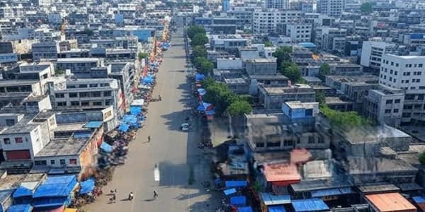
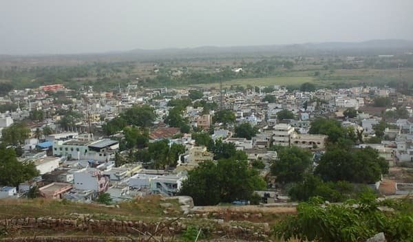
Yavatmal is a large district in the Vidarbha region of Maharashtra, with Yavatmal city as its administrative headquarters. It is closely associated with cotton cultivation and is widely known as a major cotton-growing district. Its landscape includes agricultural plateaus, forest tracts and the Penganga valley, while Pusad, Wani, Darwha, Digras, Umarkhed and Pandharkawada are important regional centres. A separate district was organised in 1864 under the name South-East Berar, later known as Wani, and the district name was changed to Yavatmal in 1905. Tipeshwar Wildlife Sanctuary, Chintamani Ganpati at Kalamb and Sahastrakund Waterfall are among its best-known attractions.
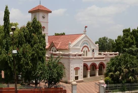
Quick Overview of Yavatmal District
| Particular | Details |
| State | Maharashtra |
| District Headquarters | Yavatmal |
| Area | 13,582 sq. km |
| Population | 27,72,348 – Census 2011 |
| Literacy Rate | 82.82% – Census 2011 |
| Revenue Subdivisions | 7 |
| Talukas / Tehsils | 16 |
| Village Panchayats | 1,204 on current district portal |
| Villages | 2,117 on current district portal |
| Main Court | District & Sessions Court, Yavatmal |
| Nearest Broad-Gauge Station to Headquarters | Dhamangaon Railway Station |
| Railway Station Code | DMN |
| Railway Zone / Division | Central Railway / Nagpur Division |
| Yavatmal PIN Code | 445001 |
| Nearest Major Airport | Dr. Babasaheb Ambedkar International Airport, Nagpur |
| Official District Website | yavatmal.gov.in |
Some current district webpages still carry older demographic figures. This guide therefore uses the final Census 2011 population of 27,72,348 and literacy rate of 82.82 percent, while current district pages are used for today’s administrative counts.
Where it is located
Yavatmal lies in the eastern part of Maharashtra within the Vidarbha region and forms part of Amravati Division. Amravati and Wardha districts lie towards the north, Chandrapur is to the east, Nanded and the state of Telangana lie to the south, and Washim and Hingoli are towards the west. The Penganga River follows much of the southern boundary, while the Wardha River forms an important part of the north-eastern and eastern boundary.
Administration of Yavatmal District
Yavatmal city is the district administrative headquarters. The present revenue structure consists of seven subdivisions and 16 talukas. The subdivision-wise arrangement is as follows:
Revenue Subdivisions and Talukas
- Yavatmal Subdivision – Yavatmal, Babhulgaon and Arni
- Darwha Subdivision – Darwha and Ner
- Pusad Subdivision – Pusad and Digras
- Umarkhed Subdivision – Umarkhed and Mahagaon
- Kelapur Subdivision – Kelapur, Zari Jamni and Ghatanji
- Ralegaon Subdivision – Ralegaon and Kalamb
- Wani Subdivision – Wani and Maregaon
Rural administration is organised through 16 Panchayat Samitis. The current district profile records 1,204 village panchayats and 2,117 villages. Exact village jurisdiction should be checked with the relevant tahsil when it is needed for an official document.
Urban Local Bodies
The district public-utility directory currently lists eight municipal councils:
- Yavatmal Municipal Council
- Darwha Municipal Council
- Digras Municipal Council
- Ghatanji Municipal Council
- Pandharkawada Municipal Council
- Pusad Municipal Council
- Umarkhed Municipal Council
- Wani Municipal Council
Yavatmal District Court
The principal district judiciary is the District and Sessions Court at Yavatmal. Subordinate and additional court establishments also operate at several taluka centres including Darwha, Pusad, Kelapur, Wani, Umarkhed and Digras.
District Court Location
District and Sessions Court, Nyay Mandir, District Court Complex, Dhamangaon Road, Near Main Post Office, Yavatmal, Maharashtra – 445001
The exact court complex depends on the nature and jurisdiction of a case. Litigants should check the current case status, cause list and court establishment through the eCourts service before travelling, particularly when a matter is listed at an outlying taluka court rather than the Yavatmal headquarters complex.
Railway Connectivity in Yavatmal District
Yavatmal city does not have the kind of regular broad-gauge passenger rail connectivity available at many district headquarters. The district administration identifies Dhamangaon as the nearest railway station for Yavatmal headquarters, at about 49 km by road. Dhamangaon lies in neighbouring Amravati district on the Mumbai-Nagpur main railway corridor.
Nearest Railway Station – Dhamangaon
Station Code: DMN
Railway Zone: Central Railway
Railway Division: Nagpur Division
Dhamangaon is an NSG-5 station on Central Railway. Badnera, near Amravati, is another useful railhead about 83 km from Yavatmal, while Wani station serves the eastern part of the district.
Yavatmal and Darwha were historically linked by the narrow-gauge Shakuntala Railway. Travellers should not assume regular passenger service on this line and should check current broad-gauge options from Dhamangaon or Badnera.
Road Connectivity
Road transport is the main way to move within Yavatmal district. NH-361 links Yavatmal with Mahagaon and Umarkhed towards the south-west and Wardha towards the north-east, with onward connections towards Nanded and Nagpur.
NH-44 serves the eastern Kelapur-Pandharkawada belt, while state highways and district roads connect the remaining taluka headquarters. MSRTC buses are widely used for intercity and rural travel.
Nearest Airport to Yavatmal
Yavatmal does not have a major airport with a broad scheduled-flight network. The district administration identifies Dr. Babasaheb Ambedkar International Airport, Nagpur, about 151 km from the headquarters, as the main air gateway.
Yavatmal District Pin Code
The main PIN code of Yavatmal city is 445001. Different taluka headquarters and towns use separate 445-series PIN codes. Some useful codes are:
- Yavatmal – 445001
- Babhulgaon – 445101
- Ner – 445102
- Arni – 445103
- Darwha – 445202
- Digras – 445203
- Pusad – 445204
- Mahagaon – 445205
- Umarkhed – 445206
- Ghatanji – 445301
- Kelapur / Pandharkawada – 445302
- Maregaon – 445303
- Wani – 445304
- Kalamb – 445401
- Ralegaon – 445402
A taluka PIN code is not necessarily the code for every village in that taluka. The exact post office should be confirmed for legal, banking or government correspondence.
Major Tourist Places in Yavatmal District
Tipeshwar Wildlife Sanctuary
Tipeshwar Wildlife Sanctuary near Pandharkawada is the district’s best-known wildlife destination. Covering about 148.63 sq. km, its hilly forest supports tiger, hyena, chital, blackbuck, sambar, jackal, wild boar, nilgai, wild cats, bears and many bird species.
Sahastrakund Waterfall
Sahastrakund is a seasonal waterfall on the Vidarbha-Marathwada boundary, approached from the Umarkhed side of Yavatmal. It is most impressive during and after the monsoon; visitors should be cautious near slippery rocks and strong currents.
Shri Chintamani, Kalamb
The Chintamani Ganpati temple at Kalamb is an important pilgrimage place. Its sanctum lies below ground level, and Kalamb is about 20-22 km from Yavatmal city by road.
Baba Kambalposh Dargah, Arni
The Baba Kambalposh Dargah at Arni, near the Arunavati River, is a well-known religious landmark. Its annual Urs attracts visitors from different communities.
Jagdamba Devi Temple, Kelapur
Kelapur is known for the Shri Jagdamba Devi temple, an important shrine for devotees from the Pandharkawada-Kelapur region.
FAQs About Yavatmal District
Q. What is the STD code for Yavatmal city?
The STD telephone code for Yavatmal is 07232, according to the district's current STD and PIN code directory.
Q. Is Tipeshwar a national park or a wildlife sanctuary?
Tipeshwar is officially a wildlife sanctuary, not a national park. The district tourism page places it in the Pandharkawada area.
Q. Does Yavatmal have notified tribal development areas?
Yes. The district profile lists 334 Tribal Sub-Plan villages, 122 Additional Sub-Plan villages, 160 MADA villages and 22 Mini-MADA villages.
Q. What is the average annual rainfall recorded for Yavatmal district?
The current district profile gives an annual average rainfall of about 911.34 mm, though rainfall can vary considerably from one taluka and year to another.
Q. Which important rivers drain Yavatmal besides the Penganga?
The Wardha is another major boundary river. Its district tributaries include the Bembla and Nirguda, while the Penganga receives rivers such as the Pus, Arha, Aran, Waghavi and Kunj.
Q. Why are both Kelapur and Pandharkawada used in addresses?
Kelapur is the taluka name, while Pandharkawada is the principal municipal town within that taluka. Government records therefore often use forms such as Pandharkawada, Taluka Kelapur.