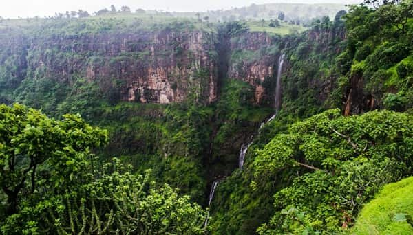
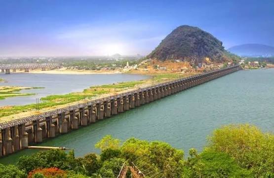
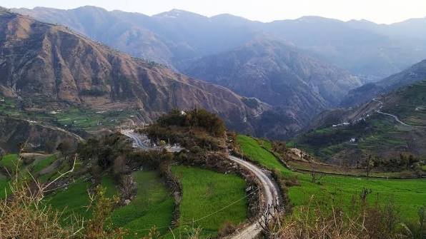
Wayanad is a highland district in north-eastern Kerala, with Kalpetta as its administrative headquarters. It was formed on 1 November 1980 as the 12th district of Kerala by carving out areas from the former Kozhikode and Kannur districts. The name is traditionally linked with “Vayal Nadu”, meaning the land of paddy fields. Wayanad is known for its Western Ghats landscape, forests, coffee and spice plantations, tribal heritage, wildlife and archaeological sites. Edakkal Caves, Banasura Sagar Dam, Pookode Lake, Chembra Peak, Muthanga, Tholpetty, Kuruva Island and Thirunelli Temple are among its best-known attractions. The current district portal records a population of 8,17,420 and a literacy rate of 89.03 percent based on Census 2011.
Quick Overview of Wayanad District
| Particular | Details |
| State | Kerala |
| District Headquarters | Kalpetta |
| District Formation | 1 November 1980 |
| Area | 2,132 sq. km on the current district homepage |
| Population | 8,17,420 |
| Literacy Rate | 89.03% |
| Revenue Divisions | 1 |
| Revenue Division | Mananthavady |
| Taluks | 3 |
| Development Blocks | 4 |
| Grama Panchayats | 23 |
| Revenue Villages | 49 |
| Municipalities | 3 |
| Main Court | District & Sessions Court, Kalpetta |
| Railway Station in District | None |
| Nearest Major Railway Station | Kozhikode Railway Station |
| Main Kalpetta PIN Code | 673121 |
| Court / North Kalpetta PIN | 673122 |
| Nearest Major Airport | Calicut International Airport |
| Official District Website | wayanad.gov.in |
The current official portal has a small geographical-area difference. The District At a Glance homepage shows 2,132 sq. km, while the Demography page shows 2,130 sq. km. Both pages agree on the population, literacy rate and administrative structure. This guide uses 2,132 sq. km because it is the current homepage figure.
Location of Wayanad District
Wayanad lies in the north-eastern part of Kerala on a plateau within the Western Ghats. Karnataka borders it to the north and east, Tamil Nadu lies to the south-east, while Kannur, Kozhikode and Malappuram districts lie on the Kerala side. The district administration describes the plateau as lying roughly 700 to 2,100 metres above mean sea level.
The landscape consists of forested hills, valleys, paddy fields and plantation belts. Coffee, pepper, cardamom, tea, ginger and other spices are important crops. The Kabani river system and its tributaries drain much of the district, while extensive forest areas connect with larger wildlife landscapes across Kerala, Karnataka and Tamil Nadu.
Administration of Wayanad District
Kalpetta is the headquarters of the district administration and contains the Civil Station and major district offices. Wayanad has one revenue division, named Mananthavady, three taluks and four development blocks.
Taluks of Wayanad District
- Vythiri
- Mananthavady
- Sulthan Bathery
Development Blocks
- Kalpetta
- Mananthavady
- Panamaram
- Sulthan Bathery
The current district portal records 49 revenue villages and 23 Grama Panchayats. Revenue administration is handled through the Mananthavady Revenue Divisional Office and the taluk offices at Vythiri, Mananthavady and Sulthan Bathery.
Municipalities
- Kalpetta Municipality
- Mananthavady Municipality
- Sulthan Bathery Municipality
Kalpetta is the administrative and central commercial base, Mananthavady serves the northern part of the district, and Sulthan Bathery is an important commercial and transport centre close to the Karnataka and Tamil Nadu approaches.
Wayanad District Court
The principal judicial establishment is the District and Sessions Court at Kalpetta. The Kalpetta Court Complex also houses Additional District and Sessions Courts, the Chief Judicial Magistrate Court, Munsiff Court, Motor Accidents Claims Tribunal and Family Court. Separate judicial establishments operate at Sulthan Bathery and Mananthavady.
District Court Location
District and Sessions Court, Kalpetta, Kalpetta North Post, Wayanad, Kerala – 673122
The court complex is in the North Kalpetta area. This is useful to note because the main Kalpetta Head Post Office uses PIN 673121, while the court and several Civil Station-side addresses use 673122. Citizens can use official eCourts services for case status, hearing dates, cause lists, orders and CNR details.
Railway Connectivity in Wayanad District
Wayanad district does not have a railway line or passenger railway station. The official district tourism pages identify Kozhikode Railway Station as the nearest major railhead for Wayanad.
Kozhikode has broad-gauge rail connections with major Kerala cities and long-distance routes towards Mangaluru, Bengaluru-side connections, Chennai, Mumbai and other parts of India. From Kozhikode station, travellers normally continue to Kalpetta by bus, taxi or private vehicle. The district tourism pages place Kalpetta roughly 75 km from Kozhikode by road.
Which Railway Station Is Best for Wayanad?
Kozhikode is the most generally useful railhead for Kalpetta, Vythiri and much of central Wayanad. Visitors heading to northern Wayanad may sometimes compare other railheads according to their train and road route, but the district administration consistently identifies Kozhikode as the nearest railway station for Wayanad as a whole.
Road Connectivity
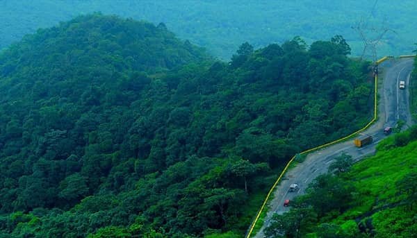
Road transport is the backbone of Wayanad travel. National Highway 766 connects Kozhikode with Kalpetta and continues through Sulthan Bathery towards Mysuru in Karnataka. Kalpetta Municipality describes the town as lying directly on the Kozhikode-Mysuru NH-766 corridor.
Important roads also connect Kalpetta with Mananthavady, Padinjarathara, Meppadi and Panamaram, while Sulthan Bathery has road links towards Ooty, Gudalur, Mysuru and other inter-state destinations. The Thamarassery Ghat road between Kozhikode and Wayanad has steep curves and can become slow during rain, holidays and heavy traffic, so travellers should allow extra time.
Nearest Airport to Wayanad
Wayanad does not have a commercial airport. The district’s current tourism pages identify Calicut International Airport as the nearest airport and place it at about 90 km from Wayanad/Kalpetta. Taxis are available from the airport, and travellers can continue through Kozhikode and the Thamarassery Ghat road towards Kalpetta.
Because Wayanad is a large district, airport convenience can vary by final destination. However, for a general district guide and for Kalpetta, the official district recommendation is Calicut International Airport.
Wayanad Pin Code
The main PIN code of Kalpetta is 673121. India Post lists Kalpetta Head Post Office under PIN 673121, while North Kalpetta and several Civil Station-side addresses, including the District Court, use 673122.
- Kalpetta – 673121
- Kalpetta North / District Court area – 673122
- Vythiri – 673576
- Meppadi – 673577
- Sulthan Bathery – 673592
- Ambalavayal – 673593
- Pulpally – 673579
- Mananthavady – 670645
- Panamaram – 670721
Therefore, 673121 should not be used for every Wayanad address. The district spans both 673-series and 670-series postal zones, and the exact PIN should be checked for the specific locality.
Major Tourist Places in Wayanad District
Edakkal Caves
Edakkal Caves near Ambalavayal are among Wayanad’s most important archaeological attractions. The rock shelter contains ancient engravings, with the district tourism page stating that the oldest examples date back to around 6000 B.C. The site is about 26.6 km from Kalpetta and involves an uphill approach, so comfortable footwear is advisable.
Banasura Sagar Dam
Banasura Sagar is one of the district’s signature landscapes. The dam is built across the Karamanathodu tributary of the Kabani River and is promoted by the district administration as India’s largest earthen dam. It lies about 21 km from Kalpetta and is known for reservoir views, surrounding hills and boating.
Pookode Lake and Lakkidi
Pookode is a natural freshwater lake surrounded by evergreen hills and lies about 3 km from Vythiri. Boating and short recreational visits are popular here. Nearby Lakkidi is one of the main viewpoints on the Kozhikode-Wayanad ghat route and is a convenient stop when entering the district from Kozhikode.
Chembra Peak
Chembra, near Meppadi, is identified by the district administration as the highest hill in Wayanad and is a major trekking destination. Trekking access, permits and allowed routes can change according to weather and forest-safety conditions, so visitors should check the latest local instructions before planning a climb.
Muthanga and Tholpetty Wildlife Areas
Wayanad Wildlife Sanctuary is approached mainly through Muthanga in the south-east and Tholpetty in the north. Muthanga lies about 16 km east of Sulthan Bathery near the Karnataka border, while the current Tholpetty page places it about 54.5 km from Kalpetta. Wildlife viewing is controlled by the Forest Department and depends on current safari timings and conditions.
Thirunelli Temple and Kuruva Island
Thirunelli Temple is an ancient Vishnu temple set amid the forests and mountains of northern Wayanad and is especially associated with ancestral rites. The district culture page places it about 64 km from Kalpetta and 29 km from Mananthavady. Kuruva Island, a protected river-island forest in the Kabani system, lies about 17 km east of Mananthavady and is another major nature attraction on the northern side.
FAQs About Wayanad District
Q. Does Wayanad have a railway station?
No. Wayanad district is not connected by rail. The official district tourism pages identify Kozhikode Railway Station as the nearest major station, with onward travel to Kalpetta by road.
Q. Which town is the best central base for a first Wayanad trip?
Kalpetta is the most central administrative and transport base for many itineraries. Banasura Sagar, Vythiri, Pookode, Meppadi and Edakkal-side routes are reasonably accessible from Kalpetta, while northern attractions are easier from Mananthavady and southern or eastern attractions from Sulthan Bathery.
Q. Can Edakkal Caves and Banasura Sagar Dam be covered on the same day?
It is possible with an early start and private transport, but the two attractions lie in different directions from Kalpetta. Visitors who want a relaxed pace may find it better to combine Edakkal with Ambalavayal or Sulthan Bathery-side places and keep Banasura for another half-day.
Q. Which airport is nearest to Wayanad?
The district administration identifies Calicut International Airport as the nearest airport, about 90 km from Wayanad/Kalpetta. The final road distance varies according to the destination within the district.
Q. Is 673121 the PIN code for all of Wayanad?
No. 673121 is the main Kalpetta PIN. North Kalpetta and the District Court use 673122, while Sulthan Bathery, Vythiri, Meppadi, Mananthavady, Panamaram and other places have different PIN codes.
Q. Is monsoon travel in Wayanad always possible?
Road travel normally continues, but heavy rain can affect ghat traffic, trekking, waterfalls and forest tourism. Trekking routes or tourist centres may be temporarily restricted for safety, so visitors should check current district, tourism and Forest Department notices before travelling during intense monsoon periods.