Nandurbar is a district in the Khandesh region of northwestern Maharashtra, with Nandurbar city serving as its administrative headquarters. It is one of Maharashtra’s important tribal-majority districts and shares interstate boundaries with both Gujarat and Madhya Pradesh. Nandurbar was created on 1 July 1998 after the former Dhule district was divided into Dhule and Nandurbar districts. The district is characterised by the Satpura hills, Tapi and Narmada river systems, agricultural plains and tribal settlements. Toranmal hill station, Prakasha, Unapdev hot springs and traditional fairs are among its major attractions. The current official district profile records an area of 5,955 sq. km, a Census 2011 population of 16,48,295 and a literacy rate of 64.38%.
Quick Overview of Nandurbar District
| Particular | Details |
| State | Maharashtra |
| Administrative Division | Nashik Division |
| District Headquarters | Nandurbar |
| District Formation | 1 July 1998 |
| Area | 5,955 sq. km |
| Population | 16,48,295 |
| Literacy Rate | 64.38% |
| Revenue Sub-Divisions | 3 |
| Talukas | 6 |
| Gram Panchayats | 639 |
| Revenue Villages | 887 |
| Municipal Councils | 4 |
| Nagar Panchayat | 1 |
| Main Court | District and Sessions Court, Nandurbar |
| Main Railway Station | Nandurbar Railway Station |
| Railway Station Code | NDB |
| Railway Zone | Western Railway |
| Railway Division | Mumbai Central Division |
| Main Nandurbar PIN Code | 425412 |
| Nearest Airport | Surat Airport |
| Official District Website | nandurbar.gov.in |
The district administration lists three revenue subdivisions and six talukas, while its detailed profile records 639 Gram Panchayats and 887 revenue villages.
Location of Nandurbar District
Nandurbar occupies the northwestern corner of Maharashtra. Gujarat lies to its west and north, Madhya Pradesh to the north and northeast, and Dhule district towards the south and southeast. The Narmada River forms part of the northern boundary.
The district lies partly in the Satpura mountainous region and partly in flatter land towards the south. The Tapi River flows east to west through the district, dividing it broadly into northern hill areas and southern plains.
Nandurbar has a large tribal population, particularly in the Akkalkuwa and Akrani areas. Bhili, Pawari, Kokani, Ahirani, Marathi, Gujarati and Hindi are among the languages spoken in different parts of the district.
Administration of Nandurbar District
Nandurbar city is the district headquarters and falls under Nashik Division.
The district has three Revenue Sub-Divisions:
- Nandurbar
- Shahada
- Taloda
These contain six talukas:
- Nandurbar
- Navapur
- Shahada
- Taloda
- Akkalkuwa
- Akrani (Dhadgaon)
The official administrative directory confirms this six-taluka structure.
Urban Local Bodies
Nandurbar district has four Municipal Councils:
- Nandurbar
- Navapur
- Shahada
- Taloda
Akrani also has a Nagar Panchayat. These bodies handle sanitation, roads, drainage, water supply, street lighting and other local civic functions.
Nandurbar District Court
The principal judicial establishment is the District and Sessions Court, Nandurbar.
The district judicial system includes the Principal District and Sessions Court along with Additional District Courts, Civil Courts, the Chief Judicial Magistrate Court and other subordinate establishments. Court establishments also function at places including Shahada, Navapur, Taloda, Dhadgaon and Akkalkuwa.
Citizens can use official eCourts services to check case status, cause lists, hearing dates, CNR details and court orders.
District Court Location
The main judicial complex is located at:
District and Sessions Court, Tokar Talav Road, near Collector Office, Nandurbar, Maharashtra – 425412
Bombay High Court records confirm the District Court at Nandurbar under PIN 425412, while government records place the court complex in the Tokar Talav/Collector Office area.
Nandurbar Railway Station
Nandurbar Railway Station is the principal railway station serving the district headquarters.
Railway Station Code: NDB
Indian Railways lists Nandurbar under Western Railway’s Mumbai Central Division. It is classified as an NSG-5 station.
The station provides useful connections towards:
- Surat
- Ahmedabad
- Mumbai-side routes
- Jalgaon
- Bhusawal
- Other destinations in western and central India
Maharashtra Tourism identifies Nandurbar as a well-connected station on the Western Railway network.
Nandurbar Railway Station Location
Nandurbar Railway Station is located within Nandurbar city – 425412 and provides convenient access to the main market, government offices and residential areas.
Local transport around the station generally includes:
- Autorickshaws
- Shared autos
- Taxis
- Buses
- Private vehicles
For travellers visiting the more remote northern parts of the district, onward road travel is normally required.
Road Connectivity
Road transport is particularly important in Nandurbar because many tribal settlements, hill areas and tourist attractions are far from railway lines.
Regular road connections are available towards:
- Dhule
- Shahada
- Taloda
- Navapur
- Akkalkuwa
- Surat
- Nashik
State transport and private buses operate between Nandurbar and major neighbouring cities. Maharashtra Tourism also highlights direct road access from Surat, Mumbai and other regional centres.
Nearest Airport to Nandurbar
Nandurbar does not have a commercial airport.
The nearest practical airport to Nandurbar city is Surat Airport, approximately 140 km away. Maharashtra Tourism identifies Surat as the nearest airport and notes that onward travel to Nandurbar is available by road.
Chhatrapati Sambhajinagar Airport is another option for travellers approaching from the Maharashtra side, but it is farther from Nandurbar city.
Nandurbar Pin Code
The main PIN code of Nandurbar city is 425412.
India Post officially lists:
Nandurbar – 425412.
Other important postal codes include:
- Shahada – 425409
- Sarangkheda – 425410
- Taloda – 425413
- Dhadgaon – 425414
- Akkalkuwa – 425415
- Navapur – 425418
- Prakasha – 425422
Therefore, 425412 should not be used for every address in Nandurbar district.
Major Tourist Places in Nandurbar District
Toranmal
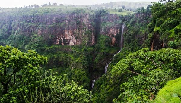
Toranmal is the district’s best-known hill station. Attractions include Yashwant Lake, Sita Khai valley, waterfalls and surrounding Satpura scenery. Maharashtra Tourism recommends the cooler period, particularly after the monsoon, for sightseeing.
Prakasha
Prakasha is a pilgrimage centre in Shahada taluka on the banks of the Tapi River. Often called Dakshin Kashi or South Kashi, it is known for the Kedareshwar Mahadev Temple and other religious sites. It is about 22 km from Nandurbar.
Unapdev
Unapdev is famous for its natural hot-water spring near Adavad village in Shahada taluka. It is around 25 km from Shahada and is also a popular local picnic destination.
Asthamba
Asthamba is a religious and cultural site in Akrani taluka. A major tribal fair is held here around Diwali and traditionally continues for several days.
FAQs About Nandurbar District
Q. Which railway station is better for visiting Toranmal?
Nandurbar and Dondaicha are both useful options. The district tourism department places Nandurbar about 84 km from Toranmal and Dondaicha about 75 km away. The better choice depends on which train is available and the onward road connection.
Q. What is the best time for a Toranmal trip?
Maharashtra Tourism recommends roughly October to May, with the post-monsoon and winter months particularly comfortable for sightseeing. Visitors should still check hill-road conditions during or immediately after very heavy rain.
Q. Is Prakasha practical as a short trip from Nandurbar city?
Yes. Prakasha is around 22 km from Nandurbar and about 13 km from Shahada, making it suitable for a half-day religious or sightseeing trip by road.
Q. When should travellers expect the biggest gathering at Asthamba?
The main Asthamba tribal fair takes place around Diwali and may continue for approximately 10–15 days. Visitors interested in local tribal traditions may prefer this period, while those wanting a quieter visit should avoid the main fair dates.