Kandhamal is a hilly and forest-rich district in central-southern Odisha, with Phulbani as its administrative headquarters. The present revenue district came into existence on 1 January 1994 after the former Phulbani district was divided into Kandhamal and Boudh. The district is known for its large tribal population, cool hill destinations, coffee and turmeric cultivation, dense forests, waterfalls and traditional handicrafts. Daringbadi is its best-known tourist destination, while Putudi Waterfall, Mandasaru, Belghar and the temples around Phulbani add to the district’s appeal. Kandhamal had a population of 7,33,110 in the 2011 Census and a literacy rate of about 64.1 percent.
Quick Overview of Kandhamal District
| Particular | Details |
| State | Odisha |
| District Headquarters | Phulbani |
| District Formation | 1 January 1994 |
| Area | 8,021 sq. km in Census-linked Odisha records |
| Population | 7,33,110 |
| Literacy Rate | 64.1% |
| Subdivisions | 2 |
| Tahasils | 12 |
| Development Blocks | 12 |
| Gram Panchayats | 171 |
| Villages | 2,506 in the district survey report |
| Urban Local Bodies | 1 Municipality and 2 NACs |
| Main Court | District & Sessions Court, Phulbani |
| Nearest Major Railway Station | Berhampur Railway Station |
| Railway Station Code | BAM |
| Main Phulbani PIN Code | 762001 |
| Nearest Major Airport | Biju Patnaik International Airport, Bhubaneswar |
| Official District Website | kandhamal.odisha.gov.in |
Official Odisha sources do not all use the same geographical-area figure. Census-linked state records and district survey material use about 8,021 sq. km, while a newer Mission Shakti district profile gives 7,654 sq. km. This guide uses 8,021 sq. km because it is the figure tied to the 2011 Census district dataset.
Location of Kandhamal District
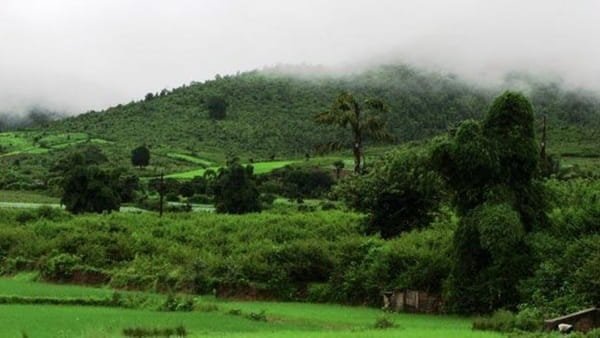
Kandhamal lies in the hill country of central-southern Odisha. Boudh lies to the north, Kalahandi to the west, while Ganjam, Nayagarh, Rayagada and Gajapati lie around its eastern and southern boundaries. The district consists largely of plateaus, valleys, steep hill ranges and forested slopes connected with the Eastern Ghats.
Phulbani lies on a broken plateau surrounded by hills, while the Balliguda side contains higher uplands and long valleys. The district is known for turmeric, ginger, coffee, millets, paddy and forest produce. Kandhamal turmeric has become particularly well known because of its strong colour and local identity. Traditional bamboo, cane, terracotta and metal crafts are also associated with the district.
Administration of Kandhamal District
Phulbani is the district headquarters. Kandhamal has two subdivisions – Phulbani and Balliguda – and 12 tahasils and development blocks.
Phulbani Subdivision
- Phulbani / Kandhamal
- Khajuripada
- Phiringia
Balliguda Subdivision
- Balliguda
- Chakapada
- Daringbadi
- Udayagiri
- Nuagaon
- Kotagarh
- Raikia
- Tikabali
- Tumudibandh
The district survey report lists 171 Gram Panchayats and 2,506 villages, including inhabited and uninhabited settlements. Urban administration is centred on Phulbani Municipality, Balliguda NAC and G. Udayagiri NAC. Because many villages are scattered across hill and forest areas, block and Gram Panchayat administration is especially important for delivery of local services.
Kandhamal District Court
The principal judicial establishment is the District and Sessions Court at Phulbani. The District Court building houses the District and Sessions Judge, Additional District and Sessions Judge, Chief Judicial Magistrate, SDJM and other judicial offices. A separate Superior Court Building nearby accommodates the Family Court and the Additional District and Sessions Judge-cum-Special Judge (Vigilance). Courts also function at Balliguda, G. Udayagiri and Daringbadi.
District Court Location
District Court Complex, Phulbani, Kandhamal, Odisha – 762001
The official district court page places the court between the Superintendent of Police office and Coronation Field beside the main road in Phulbani. It is around 1 km from the Phulbani bus stand. Citizens can use eCourts services for case status, hearing dates, cause lists, orders and CNR searches.
Railway Connectivity in Kandhamal District
Kandhamal district headquarters does not have a railway station. The official district travel page identifies Berhampur Railway Station as the nearest major railhead to Phulbani, about 165 km away.
Berhampur Railway Station Code: BAM
Berhampur is on the important east-coast rail corridor and has long-distance connections towards Bhubaneswar, Visakhapatnam, Chennai, Kolkata and other cities. From Berhampur, travellers continue to Phulbani, Daringbadi and other parts of Kandhamal by road. For some western destinations, road routes from neighbouring districts may be more practical depending on the starting point.
Road Connectivity
Road transport is the main way to travel within Kandhamal. Phulbani has regular bus connections with Bhubaneswar, Berhampur and other Odisha cities, while buses and taxis connect the headquarters with Daringbadi, Balliguda, Raikia, G. Udayagiri, Tikabali and other block centres.
Travel times can be longer than the map distance suggests because many roads pass through hills, forest stretches and winding ghats. Visitors going to remote waterfalls or forest destinations should prefer daytime travel and check local road conditions during the monsoon.
Nearest Airport to Kandhamal
Kandhamal does not have a commercial airport. The official district travel page identifies Biju Patnaik International Airport at Bhubaneswar as the nearest major airport to Phulbani, about 211 km from the district headquarters.
The actual road distance varies by destination. Daringbadi is farther from Bhubaneswar than Phulbani, while visitors approaching the southern side of Kandhamal may sometimes find a Berhampur-side road journey more convenient after reaching Odisha by rail.
Kandhamal Pin Code
The main PIN code of Phulbani is 762001. India Post records confirm Phulbani Division and Phulbani Head Office under PIN 762001. Different block headquarters and towns in Kandhamal use different postal codes.
- Phulbani – 762001
- Udayagiri – 762100
- Raikia – 762101
- Nuagaon – 762102
- Balliguda – 762103
- Daringbadi – 762104
- Kotagarh – 762105
- Tumudibandh – 762107
- Tikabali – 762010
- Phiringia – 762011
Therefore, 762001 should not be used for every address in Kandhamal district. The exact PIN should be checked for the specific town, village or serving post office.
Major Tourist Places in Kandhamal District
Daringbadi
Daringbadi is Kandhamal’s most famous hill destination and lies at about 3,000 feet above sea level. It is popularly called the ‘Kashmir of Odisha’ and is known for pine forests, coffee gardens, valleys and cool winter weather. The district tourism page places it about 120 km from Phulbani and about 130 km from Berhampur Railway Station.
Putudi Waterfall
Putudi Waterfall is about 18 km from Phulbani. Here the Salunki River drops about 60 feet through a forested setting. The short distance from the district headquarters makes it one of the easiest natural attractions to include in a Phulbani stay.
Mandasaru, Raikia
Mandasaru is a forested gorge ecosystem in the Raikia region and is often described locally as the ‘Silent Valley of Odisha’. The landscape contains a chain of hills, dense moist deciduous forest and extensive viewpoints. A nature camp on the hilltop provides accommodation and panoramic views.
Belghar
Belghar is a highland forest destination in the Tumudibandh region at roughly 2,555 feet above sea level. It is known for scenic beauty, wildlife and the traditional settlements of the Kutia Kandha community. Because it lies far from Phulbani, it is better planned as a dedicated road trip rather than a short excursion.
Barala Devi Temple and Pilasalunki
Barala Devi Temple at Balaskumpa is an important local religious site, especially during festival periods such as Dussehra. The Pilasalunki dam area, about 3 km from the temple, is also known as a picnic and scenic spot. Balaskumpa is close enough to Phulbani to combine with other nearby attractions.
FAQs About Kandhamal District
Q. Does Phulbani have a railway station?
No. Phulbani does not have a railway station. The Kandhamal district travel page identifies Berhampur Railway Station as the nearest major railhead, about 165 km from the headquarters.
Q. Is Daringbadi closer to Phulbani or Berhampur by road?
The district tourism page places Daringbadi about 120 km from Phulbani and about 130 km from Berhampur Railway Station. Travellers arriving by train at Berhampur can therefore go directly to Daringbadi without first travelling to Phulbani.
Q. Can Putudi Waterfall be covered during a short stay in Phulbani?
Yes. Putudi is only about 18 km from Phulbani, making it one of the most practical half-day nature trips from the district headquarters. Road conditions should still be checked during heavy monsoon rain.
Q. Is Mandasaru suitable for an overnight stay?
Yes. Mandasaru has a nature camp overlooking the gorge. An overnight stay can be useful for visitors who want sunrise, evening views and more time in the forested Raikia region.
Q. Is Belghar suitable for a quick day trip from Phulbani?
Not usually. The district tourism page places Belghar about 165 km from Phulbani, so the road journey is long. It is better included in a separate Tumudibandh-Belghar itinerary.
Q. Is 762001 the PIN code for the whole Kandhamal district?
No. 762001 is the main Phulbani PIN. Balliguda, Daringbadi, G. Udayagiri, Raikia, Tikabali, Phiringia and other places use different PIN codes.